After last week’s post I wanted to share some of my photos from various
visits to the Colfax Trail, built on a section of roadbed of the Spokane &
Inland Empire Railroad. The trail runs a little under three miles along the
Palouse River downstream from Colfax so it is a very gentle and even slope. I’ve
found that while this trail is most beautiful in the spring and early summer, it is also especially nice in the winter as long as you have appropriate
footwear for the ice and snow. As the Palouse River is one of the few places in the
region with open flowing water even in the coldest part of winter, you’ll find
hundreds of water birds here that would normally be residing on area lakes and
ponds when they aren’t frozen over. I've included wintertime photos below from a few different trips.
 |
| The first mile of the trail is across mostly open flood plain, with few trees for shade, so it can get hot in the summer. But just up ahead you can see the cool shade of the ponderosas inviting you to push forward. |
The Spokane & Inland Empire Railroad ran south from
Spokane and broke into two branches; a southeastern branch terminating in
Moscow, Idaho and a southwestern branch that terminated in downtown Colfax, about two
miles from the current trailhead. See this blog post from last year for a short
history of the Spokane & Inland Empire Railroad including route maps.
Construction on the Colfax Trail segment of the railroad began
in 1906 and it opened to service in August, 1907. The S&IE was purchased by
the Great Northern Railway in 1909 and fully merged into GN in 1929, which
continued to operate the line up until 1967 when it was closed due to a
structurally unsafe tunnel, and the track here was removed in either 1968 or
1969. Whitman County purchased the abandoned roadbed in 1969 in order to
provide access to a dump site right by the river, which was closed and covered soon
after to protect the river thanks to the 1971 Shoreline Management Act. The
County considered turning it into a trail as early as 1973, but like many trail
projects, it took many years (decades, actually) for that to come about.
 |
| Excerpt from a 1964 USGS topo map when the railroad was still in operation. Point A is the trailhead and Point B is the end of the trail at a former river crossing. Across the river from Point B is the tunnel that ultimately caused this segment of the line to be abandoned. Downtown Colfax is to the right, about two miles from point A. |
There is now an effort to convert another old rail line to a
trail running southeast from Colfax to Pullman. That rail segment was originally
built in 1883 by the Columbia & Palouse Railroad Company which became part
of The Oregon Railroad & Navigation Company and later on Union
Pacific. UP eventually sold off the line to the State of Washington, and it was operational up until a fire in 2006 destroyed a bridge and closed the line. I
hope to see that trail completed in my lifetime.
 |
| Looking south from the trail along the first mile. |
 |
| A few of the many, many geese and ducks you can see in the winter. Other winter residents include hawks and bald eagles, as well as forest birds that are resident year round. |
 |
| A small cataract provides beautiful sound regardless of water level. |
 |
| This rock cut was made wide enough to accommodate a second track, however, the SI&E never double-tracked this route. |
 |
| As you move downstream the basalt cliffs become more dramatic. In winter this section of the trail is in full shade but there may be sun just across the river. |
 |
| Another view of the basalt cliffs near the end of trail. |
 |
| Parts of the trail are in full shade throughout the day in winter so you will encounter snow and ice buildup. |
 |
| At this spot a large part of the cliff seems to be breaking off |
 |
| You can still find a few traces of railroad infrastructure. This may have been part of a support for the catenary that powered the electric motors. |
 |
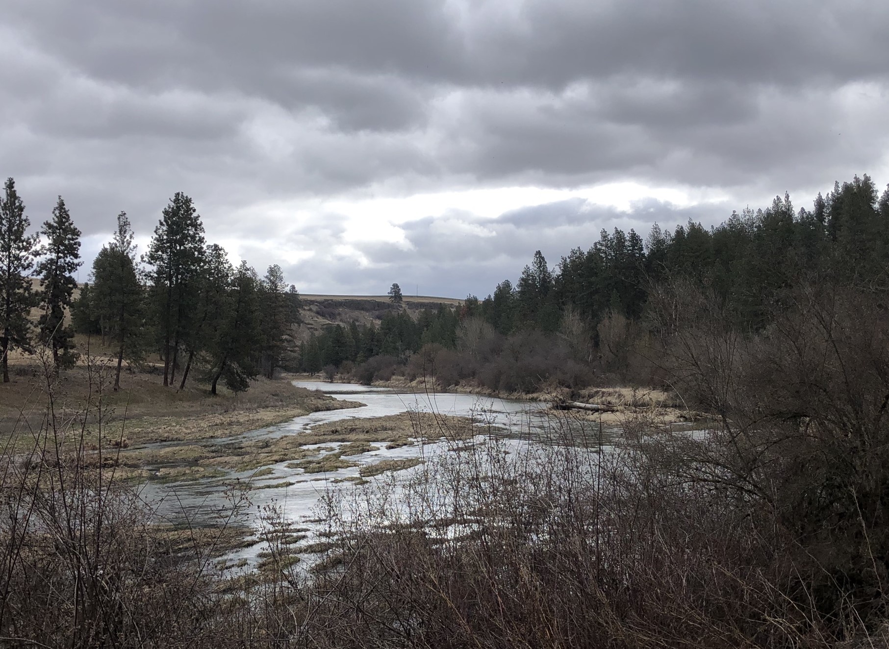
| Looking upstream on a very cloudy day when the river was running just high enough to spread out across the channel. I haven't yet been on this trail on a high water day but hope to do that someday. |
 |
| Trail ends when it runs into the river. There was a bridge here up until 1991 when it was destroyed by fire. Across the river is the tunnel that became structurally unsafe in 1967, leading to the abandonment of the line. On the other side of that tunnel was another bridge crossing the river (also destroyed), and just a little downstream from there the railroad crossed the river for a third time over the beautiful Manning-Rye Covered Bridge, a single span Howe truss, which was added to the National Register of Historic Places in 1982 and was destroyed by fire in 2020. |
 |
| A close-up of the tunnel portal. The inscription above the portal has been obscured but it may have been the year it was completed. |
References
- Carter, Clive. Inland Empire Electric Line: Spokane to
Coeur d’Alene and the Palouse. Museum of North Idaho, 2009.
- Robertson, Donald B. Encylopedia of Western Railroad
History, Volume III. Caxton Printers Ltd., 1995.
- U.S. Geological Survey. Diamond Quadrangle, Wash. 1964.
1:24,000. 7.5 Minute Series. Denver, CO: United States Department of the
Interior, USGS, 1964