Pages

Monday, November 6, 2023

Along the Spokane & Inland Empire route on the Colfax Trail

After last week’s post I wanted to share some of my photos from various visits to the Colfax Trail, built on a section of roadbed of the Spokane & Inland Empire Railroad. The trail runs a little under three miles along the Palouse River downstream from Colfax so it is a very gentle and even slope. I’ve found that while this trail is most beautiful in the spring and early summer, it is also especially nice in the winter as long as you have appropriate footwear for the ice and snow. As the Palouse River is one of the few places in the region with open flowing water even in the coldest part of winter, you’ll find hundreds of water birds here that would normally be residing on area lakes and ponds when they aren’t frozen over. I've included wintertime photos below from a few different trips.

The first mile of the trail is across mostly open flood plain, with few trees for shade, so it can get hot in the summer. But just up ahead you can see the cool shade of the ponderosas inviting you to push forward.


The Spokane & Inland Empire Railroad ran south from Spokane and broke into two branches; a southeastern branch terminating in Moscow, Idaho and a southwestern branch that terminated in downtown Colfax, about two miles from the current trailhead. See this blog post from last year for a short history of the Spokane & Inland Empire Railroad including route maps.

Construction on the Colfax Trail segment of the railroad began in 1906 and it opened to service in August, 1907. The S&IE was purchased by the Great Northern Railway in 1909 and fully merged into GN in 1929, which continued to operate the line up until 1967 when it was closed due to a structurally unsafe tunnel, and the track here was removed in either 1968 or 1969. Whitman County purchased the abandoned roadbed in 1969 in order to provide access to a dump site right by the river, which was closed and covered soon after to protect the river thanks to the 1971 Shoreline Management Act. The County considered turning it into a trail as early as 1973, but like many trail projects, it took many years (decades, actually) for that to come about.

Excerpt from a 1964 USGS topo map when the railroad was still in operation. Point A is the trailhead and Point B is the end of the trail at a former river crossing. Across the river from Point B is the tunnel that ultimately caused this segment of the line to be abandoned. Downtown Colfax is to the right, about two miles from point A.

There is now an effort to convert another old rail line to a trail running southeast from Colfax to Pullman. That rail segment was originally built in 1883 by the Columbia & Palouse Railroad Company which became part of The Oregon Railroad & Navigation Company and later on Union Pacific. UP eventually sold off the line to the State of Washington, and it was operational up until a fire in 2006 destroyed a bridge and closed the line. I hope to see that trail completed in my lifetime.


Looking south from the trail along the first mile.


A few of the many, many geese and ducks you can see in the winter. Other winter residents include hawks and bald eagles, as well as forest birds that are resident year round.


A small cataract provides beautiful sound regardless of water level.


This rock cut was made wide enough to accommodate a second track, however, the SI&E never double-tracked this route.


As you move downstream the basalt cliffs become more dramatic. In winter this section of the trail is in full shade but there may be sun just across the river.


Another view of the basalt cliffs near the end of trail.


Parts of the trail are in full shade throughout the day in winter so you will encounter snow and ice buildup.


At this spot a large part of the cliff seems to be breaking off


You can still find a few traces of railroad infrastructure. This may have been part of a support for the catenary that powered the electric motors.


Looking upstream on a very cloudy day when the river was running just high enough to spread out across the channel. I haven't yet been on this trail on a high water day but hope to do that someday.


Trail ends when it runs into the river. There was a bridge here up until 1991 when it was destroyed by fire. Across the river is the tunnel that became structurally unsafe in 1967, leading to the abandonment of the line. On the other side of that tunnel was another bridge crossing the river (also destroyed), and just a little downstream from there the railroad crossed the river for a third time over the beautiful Manning-Rye Covered Bridge, a single span Howe truss, which was added to the National Register of Historic Places in 1982 and was destroyed by fire in 2020.


A close-up of the tunnel portal. The inscription above the portal has been obscured but it may have been the year it was completed.


References

  • Carter, Clive. Inland Empire Electric Line: Spokane to Coeur d’Alene and the Palouse. Museum of North Idaho, 2009.
  • Robertson, Donald B. Encylopedia of Western Railroad History, Volume III. Caxton Printers Ltd., 1995.
  • U.S. Geological Survey. Diamond Quadrangle, Wash. 1964. 1:24,000. 7.5 Minute Series. Denver, CO: United States Department of the Interior, USGS, 1964

Monday, October 30, 2023

Along the Great Northern route through Riverside State Park

I went hiking along the old Great Northern railroad grade through Riverside State Park today. While the grade does not appear on all trail maps (including the official state park map), you can find it marked on some trail maps, and it is very easy to walk along as it was used and maintained by the railroad up until 1973. Trail 25 provides runs along a short section of the railroad grade and provides easy access to it. I had written about this trail a bit in a previous post which you can find here and I had always meant to provide more details on this route as well as photos from various trips over the last two years. It's a beautiful, easy trail that clings to the side of a bluff with great views to the north and east. Trees shade parts of the trail while much of it is exposed, making it a great option on sunny days when the weather is cooler. On warmer days it's best to visit late in the day when the bluff provides shade for the trail. 

Great Northern grade through Riverside State Park. The trail is essentially on a shelf between basalt cliffs on one side and a steep drop off on the other. Trees provide some shade relief along some stretches of the trail.

First some background on the Great Northern Railway’s arrival in Spokane, one small but important step on it’s 1,726 mile route building westward from St. Paul, Minnesota to Seattle. By early 1892 the Great Northern Railway had built within 50 miles of Spokane but had not yet determined whether it would actually enter Spokane. The challenge with Spokane was the westward climb up to the Columbia Plateau after crossing the Spokane River. An 1891 plan had the railroad passing about 10 miles to the north of Spokane where a route was identified that would be just slightly more than a one percent grade. Spokane citizens wanted the railroad to come through the city. James J. Hill, who controlled the Great Northern, claimed that going through Spokane would cost about one million dollars more (whether this estimate was true is unclear, but it was likely exaggerated), so he made an ultimatum to the city demanding that citizens offset that cost with free right of way within the city, about half of the presumed cost. Citizens capitulated to the demand within days and construction quickly followed on a line directly toward downtown. The first through train from St. Paul arrived in Spokane on May 28, 1892.

Rather than building a line west from downtown and across the river immediately, Hill reached an agreement with the Seattle, Lake Shore & Eastern Railway to temporarily use a few miles of their trackage through the western part of the city as well as their bridge over the Spokane River. About a mile west of that bridge the Great Northern built a junction with the SLS&E, eventually called Ft. Wright Junction, and began road grading westward toward Seattle sometime around or after March, 1892. Track laying began at the junction with the SLS&E on July 23, 1892 and progressed eastward about three to four miles per day, so the entire section within Riverside State Park likely was completed on the first or second day. After some winter weather delays, the last spike for the line between Spokane and Seattle was driven January 6, 1893 just west of Steven Pass and scheduled freight traffic began rolling over the line in February, although through passenger service to Seattle would not commence until June, 1893.

The grade that goes through Riverside State Park was in use by Great Northern, and later by successor Burlington Northern, until 1973 when it was replaced with a new, shorter route slightly further south. Most of the right of way through the park is now owned by the Washington State Department of Parks and Recreation, except for one stretch of right of way (near Highland on the first map below) which is somehow still owned by BNSF, successor to Burlington Northern. Between the south park boundary and Ft. Wright Junction, the old railroad right of way is still there but not easily accessible. Part of the right of way is now owned by the State of Washington, part by the City of Spokane, part by BNSF and part is a city street (N. Houston Rd.) There is a potential for this to become a developed trail in the future, providing a link to the Centennial Trail, as most of the land is publicly held. For now I’ll just have to enjoy the grade that’s within the park boundaries.

This is an excerpt from a map compiled by the Spokane County Surveyor and published in April, 1900. Map is part of the Washington State University Libraries collection. Highlighted in yellow is the section of the GN route that is within the boundaries of Riverside State Park today and is accessible to the public. At the north end of the curve is a spot labeled Highland, which is approximately where the state park boundary is today. Point A on the map is Fort Wright Junction where the GN branched off of the SLS&E route. Point B is the SLS&E crossing of the Spokane River. Point C is the the second crossing of the Spokane River that the Great Northern built a few years later, providing an easier and more direct route west from Spokane than the SLS&E route. The segment between points A and B is part of the Centennial Trail today. The north half of the segment between points A and C is preserved as it is owned by the federal government; the south half has disappeared due to development.


This excerpt from a 1954 USGS topo map shows the railroad hugging the side of the cliff. Near the top of the curve labeled 2052 (referring to elevation) is the location of Highland you saw on the previous map, very close to the park boundary today. At some point the Great Northern moved their Highland station to where you see it labeled on this map.


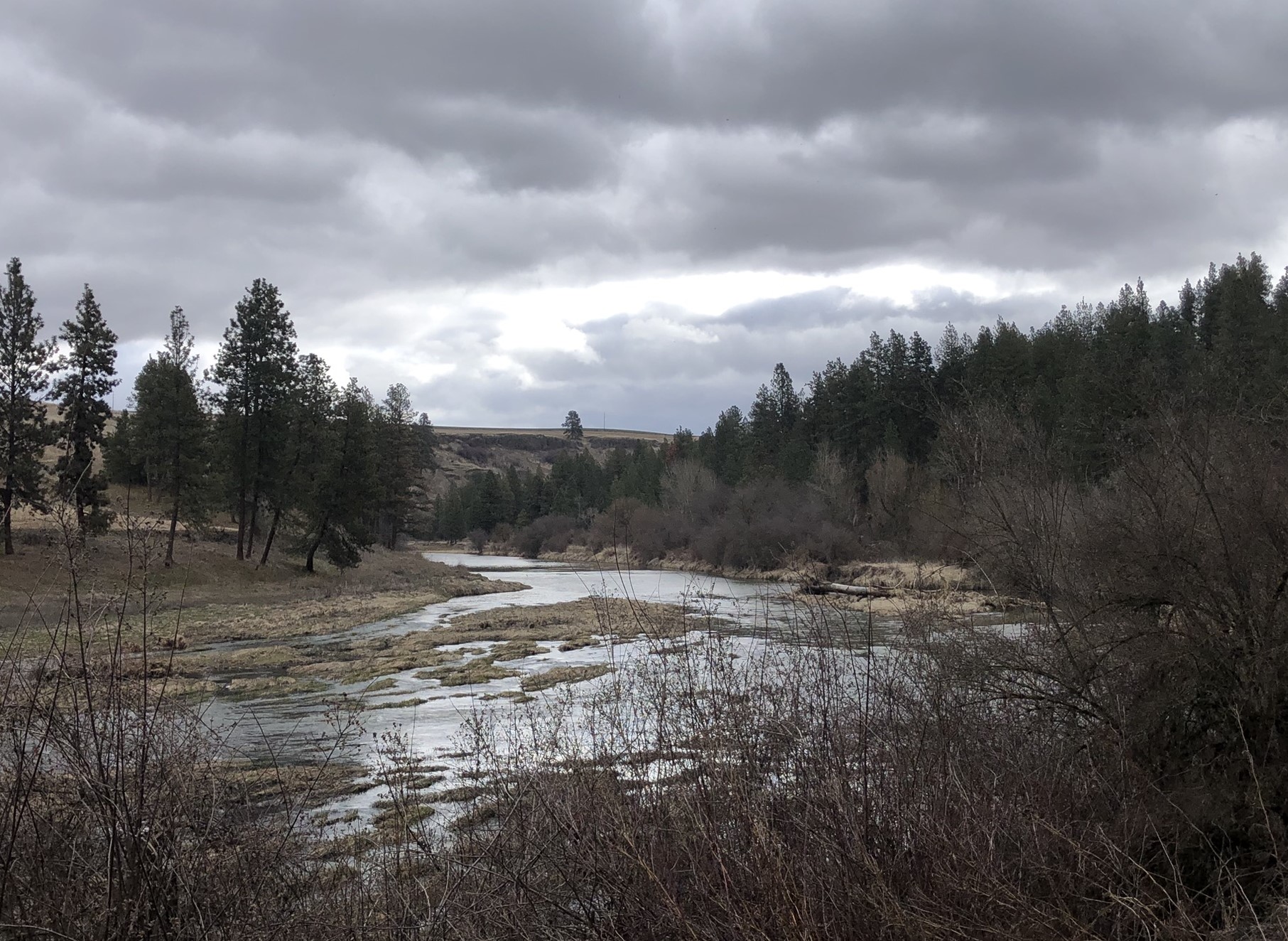
An open stretch of the trail looking north


And a photo in the same location in winter. No recent human activity on the day we visited, just deer and bird tracks in the snow.


On a foggy day the rest of the park disappears.


Old foundations for railroad equipment can be found along the route, gradually being reclaimed by nature.


Some more old equipment


It looks like an old tree stump but this was a utility pole, now being colonized by the next generation of trees.


Looking up toward the trail from below you can clearly see it cutting across the landscape. The Great Northern dumped a lot of rock here which has gradually been colonized by vegetation except for a few bare patches of talus.


Another view looking up at the trail from below. The snow highlights the railroad fill and clearly shows where the trail is.


Further north near the trail is enclosed by trees that create a tunnel effect.


As you reach the north end of the trail the trees suddenly disappear. This view is to the west from the end of the trail segment within the park boundary. Beyond this point the roadbed is still owned by BNSF but is surrounded by private property owners on both sides. Other park trails converge here so there are hiking options beyond returning on the same trail. 


References

  • Lewty, Peter J. Across the Columbia Plain: Railroad Expansion in the Interior Northwest, 1885-1893. Washington State University Press, 1995.
  • Wetzel, John. Map of Spokane County, State of Washington (1900). Scale 1/2 inch to one mile. Spokane, WA: Publisher unknown, 1900.
  • U.S. Geological Survey. Airway Heights Quadrangle, Wash. 1954. 1:24,000. 7.5 Minute Series. Denver, CO: United States Department of the Interior, USGS, 1954

Monday, October 16, 2023

Trestle work update

Not sure what happened with updates to this blog. Work on the PE&A has not progressed as quickly as I was hoping this summer due to competing priorities, but that doesn't mean nothing has happened at all. Time to provide some updates on progress over the past few months.


My main priority was to complete the curving trestle which is the first thing a visitor to the railroad would see. I was not completely happy with the work I did in the spring and I ripped out a few pieces that I didn't think looked right. The key challenge was coming up with a design to go over the rocks I had arranged here.


I repositioned the trestles on the east approach (to the left) and decided to use two short double bents to cross the rocks. I had to make a couple some adjustments to the rocks to provide an adequate surface.


This is the result, with the two short bents evenly spaced, then a large gap to the right.


Next step was to glue on supporting cross beams.

Meanwhile, I needed to finish the west approach. I had partially built this in the spring but then ran out of pre-made bents.


To transition from the west end of the trestle back to ground level I decided to use cribbing filled with crushed rock. I reused a structure I had from my old railroad and modified it to fit the space.


This shows the finished approach. I don't have ballast on the track yet as I need to extend the track before I decide on the final alignment.


This picture shows the east approach to the trestle and an industry spur to the left. I started placing ballast here once I was happy with the track alignment.


I needed a small retaining wall as the industry spur is along a slope. Nothing fancy here.


Here the wall is in place and tracks have ballast. The spur is slightly below the level of the main track so any cars spotted here won't accidentally roll back and foul the main.


Next thing I'm working on is defining the route the track will take from the main line (lower loop) to the upper loop. The main line is on the left hand side and is already partially ballasted.


This is another view of the current work area showing the slope to the upper level.


With the arrival of the fall rains some of the native plants in my garden have had a new set of blooms like this sticky geranium (Geranium viscosissimum)


Blanket flower (Gaillardia aristata)


Sunday, April 30, 2023

Starting work on trestle

Spring is definitely here but today felt more like summer, as it got up to 86° in the backyard. Spokane International Airport's official high for today was 82° which was still high enough to tie the record high temperature for today. I've been very busy recently with spring garden work like getting the irrigation system up and running, and having finished everything that needed attention I thought I would start work on the trestle work for the railroad.

Today's finished section of trestle. I used the same style and building methods I used for my earlier trestle work in Seattle.

The first step was setting up the work area and hauling everything from the garage that I would need. And then remembering something else and making another trip. Got lots of steps in today. 


Placing the foundation for the first bent. Last time I used brick for foundation; this time I thought I'd go with something simpler and just put down a bed of coarse gravel under each bent. The PVC pipes are holding up the track at the level I want. Based on the track level, I measured how high each bent would need to be.


Each bent was cut to the appropriate height and I attached a bottom sill. I dug a trench and filled it with coarse gravel for each bent. I used a double bent at both ends of this section. Here they are being held upright with a few pieces of lumber.


Gradually all the bents were connected sufficiently to hold them in place so I could put the stringers along the top of the bents. 


This picture shows progress as I added stringers on top of the bents which will support the tracks. Based on my learnings last time I did this, I cut a length of stringers to connect each bent rather than trying to run them a longer distance. I'm using three stringers, and I put spacers in between them to help secure them and keep them even. After placing them with ample glue, I weighted each section down with a rock. Once the glue sets I will knock out the spacers.


The section of trestle is mostly complete. I just need to add the diagonal braces between the bents.  


This picture shows the completed section on the left and the next challenge, creating a bridge over the rock area. For now I'm going to do a simple bridge with a support in the middle sitting on the rock. On the right of the rock you can see the foundation where the next double bent is going to be placed and the trestle will continue from there to the right.


So many flowers are blooming and the bees and other insects are now out in full force. This big bumblebee decided to visit the job site today. I think this is a Hunt's bumblebee (Bombus huntii)